228 Route 28: What the New Zoning Builds
A fully approved retail-plus-apartments building in West Yarmouth — and the first clear look at what the Route 28 overlay district produces.
A Yarmouth local issue — researched from public records and public marketing materials. This page is about the zoning, not the property owner: the owner is using the rules exactly as the Town wrote them. The question for residents is whether they know what those rules now allow — on this parcel and the ones that follow.
What’s approved
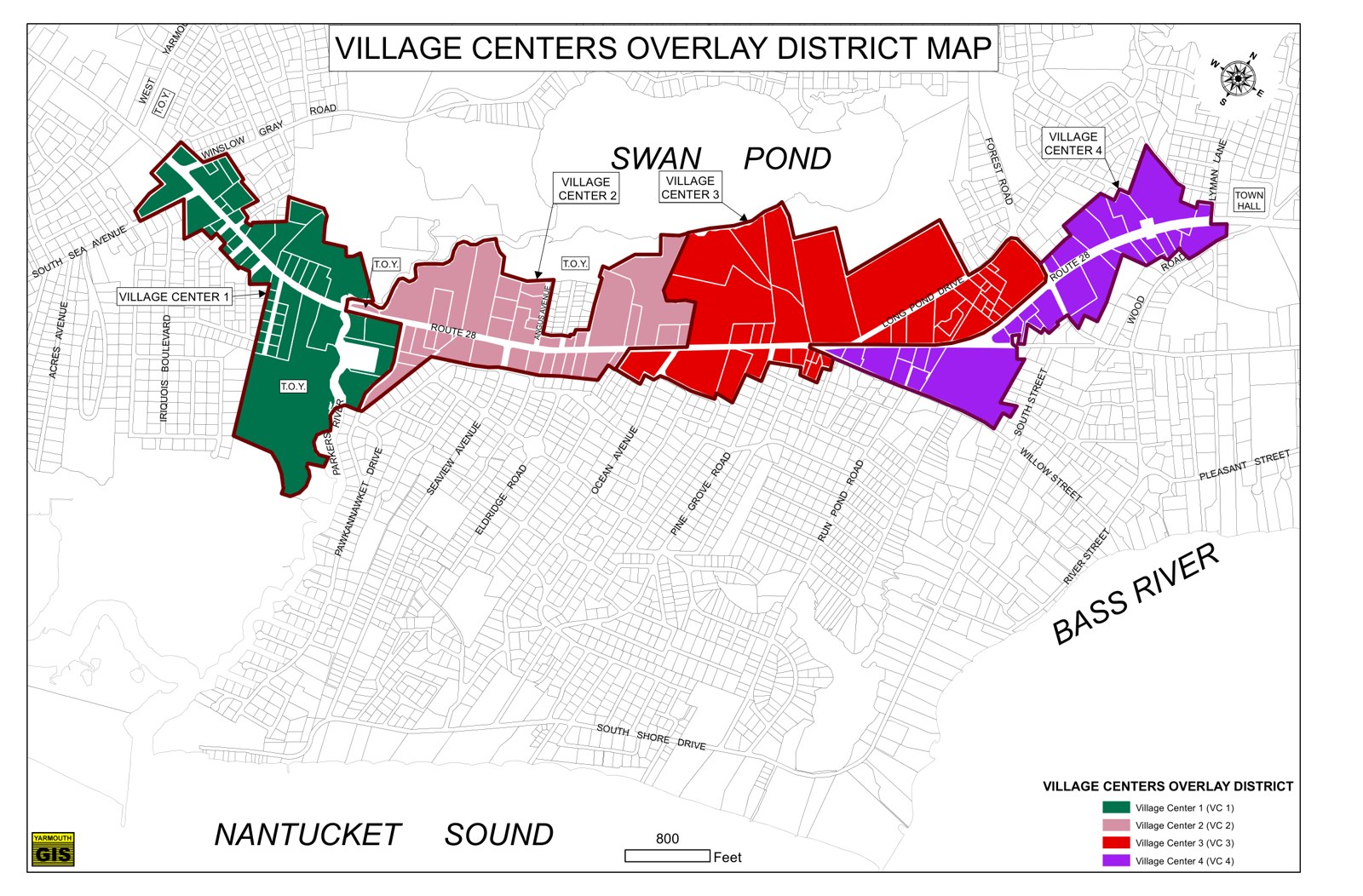
At 228 Route 28 in West Yarmouth — 1.85 acres with about 250 feet of Route 28 frontage — a mixed-use development is fully approved and being marketed as shovel-ready (listed at $2,995,000): a 19,690-square-foot two-story building with roughly 9,985 square feet of ground-floor retail and 13 second-floor apartments (ten one-bedroom, three two-bedroom). It would run on a 9,000-gallon septic system until municipal sewer reaches the parcel. The listing’s own words: buyers “can move forward without the uncertainty of the entitlement process.”
The zoning behind it
This is a product of the Village Centers Overlay District (VCOD) — the zoning the Town adopted for the Route 28 corridor to encourage redevelopment. Inside the VCOD, high-density mixed-use projects are allowed by right, with incentives for taller buildings and reduced dimensional standards. “By right” means exactly that: a project meeting the district’s standards does not need the neighborhood’s blessing, and in most cases not a discretionary vote, to exist.
Why one building matters
228 Route 28 is the corridor’s first-wave case study. Two forces are about to accelerate the pattern:
- Sewer. The town’s wastewater build-out is what today caps density on many Route 28 parcels (septic capacity). As sewer arrives, that cap lifts, parcel by parcel.
- The MassDOT corridor project. The state’s Route 28 Corridor Improvement project will take strips of land along the road for safety, bike and pedestrian improvements — and the Town has already drafted a zoning amendment giving VCOD projects setback relief because of those takings. The road project and the zoning are moving together.
Whether you think this is revitalization or overdevelopment, it deserves to happen with residents watching — not discovered building by building after the fact.
What residents can do
- Know the district. The Town’s VCOD page and bylaw are linked below — twenty minutes of reading tells you what every parcel in the overlay can become.
- Watch the Planning Board. VCOD amendments (including the corridor setback article) go through the Planning Board to Town Meeting — and Town Meeting is where zoning is decided. Your vote counts there.
- Stay informed: the YRTC is tracking the corridor, this parcel, and the zoning articles headed to Town Meeting. Email info@yarmouthrtc.com to get on the list.
Sources
- Sale listing for 228 Route 28, West Yarmouth (MLS 22603858) (acreage, building program, approval status, price)
- Town of Yarmouth — Village Centers Overlay District
- VCOD zoning bylaw excerpt
- Planning Board packet, Feb. 4, 2026 (draft VCOD setback article tied to the MassDOT corridor takings)
- Town of Yarmouth — Route 28 Project
Paid for by the Yarmouth Republican Town Committee.
Want to know when things like this happen in Yarmouth? Sign up for local issue alerts →Forest Road, the housing authority, zoning — just the alerts, nothing more.